Protection of privacy and security of personal data with RTLS

Protecting personal information is a top priority not only in healthcare, but also in real-time location systems across multiple industries. As with any software solution that processes personal data, including people´s whereabouts, there are data protection risks associated with tracking or navigating people.

The processing of personal data in the European Union is based on the General Data Protection Regulation (GDPR), in force since 2018, more specifically on Art. 6 of the GDPR. In general, however, it should be noted that – as long as none of the authorization standards of Art. 6 of the GDPR apply – data processing is prohibited. In other words, any processing of personal data requires either the consent of the data subject or the legitimate interest of the responsible party (in our case, the company using the RTLS solution).

Data protection for indoor positioning systems and RTLS

As a result, there are two legal bases for the processing of location data relating to individuals: Either the individuals have consented to being tracked or, in the case of tracking solutions that locate employees on company premises for security reasons, there may be a legitimate interest on the part of the company in ensuring the safety of the employees. Irrespective of the legal basis on which the location data is processed, the responsibility for data processing in compliance with data protection law always lies with the customer. If the processing of location data is based on the consent of the data subject, the data subject must consent to both the mere location tracking and the intended use of the data. In the example above, this would be for security purposes.

The position data in the Favendo RTLS is real-time data. In theory, only the current positions of assets or persons can be determined. At the customer’s request, the position data can also be stored directly in the company’s own databases in an anonymized form. The anonymization of the data makes it impossible to trace the position data back to an individual person, but the data can still be used for productivity analysis with the Favendo Dashboard or other analysis tools. Despite the anonymization of the data, it is advantageous, especially for people tracking, to work with tag IDs that cannot be directly assigned to a person […]

By |04.09.2023|article|

Favendo Redefines Location Solutions with the Launch of a Cutting-Edge Modular RTLS Suite

The Favendo Modular RTLS Suite enables organizations to transform their operations, enhance security protocols, streamline processes and improve customer experiences like never before.

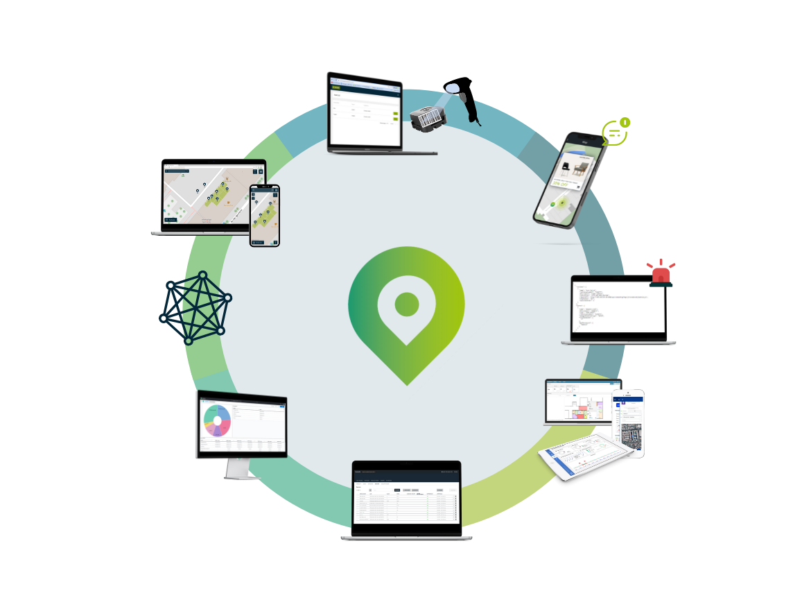
Favendo, a provider of innovative location-based solutions, is excited to announce the launch of their Modular RTLS Suite. This Software Suite incorporates state-of-the-art technology that revolutionizes industries by providing unparalleled scalability and flexibility in location-based services. The Suite’s modular design and interoperable software components allow companies of every size and industry to use real-time location data to reduce search times, increase security, improve processes and save money. The Modular RTLS Suite addresses the evolving needs of customers for location-based data analytics, RTLS with a short Return on Investment (ROI), and overall cost optimization, by simultaneously opening up new use cases.

Key components of the Favendo Modular RTLS Suite:

  • Favendo Location Engine, calculates the position of assets or people
  • Favendo Commander, backoffice for Favendo’s RTLS solutions, which allows users to manage their RTLS installations
  • Favendo API, open push/pull API that can seamlessly integrate with third-party applications
  • Favendo SDK, easy-to-integrate Software Development Kit for indoor positioning in existing iOS or Android apps
  • Favendo Viewer, intuitive web-app for locating assets on a map
  • Favendo Tagger, end-user tool for effectively managing tags and assets
  • Favendo Robot, tool that enables the creation and management of individual event routines in order to automate processes
  • Favendo Dashboard, customized Kibana dashboard to analyze and monitor location data based on the elastic.io software stack

The RTLS Suite offers a modular architecture that can easily adapt to numerous industries and use-cases. The scalable design allows businesses of any size to access its benefits and expand the solution as necessary. By integrating partner technologies from Quuppa or Actility/Abeeway, hybrid RTLS solutions can be implemented that provide high flexibility. In addition to tracking use-cases, Favendo also offers a client-based indoor positioning wayfinding solution. Organizations can tailor the solution to their specific needs and achieve maximum operational efficiency.

Consequently, customers are only charged for the modules they require, thereby reducing unnecessary costs. Businesses can adjust their investment according to their operational requirements and financial constraints. Favendo’s dedication to cost-effectiveness enables businesses to leverage cutting-edge RTLS technology without compromising on quality or exceeding their budget.

The RTLS suite is designed to seamlessly integrate with the existing infrastructure, making the implementation process smooth and […]

Hybrid RTLS: Maximize Efficiency and Safety in Industrial Settings

Dive with us into the world of Hybrid RTLS and join our webinar on “Maximizing Efficiency and Safety in Industrial Settings with Hybrid RTLS Solutions” to discover how our end-to-end tracking solution can transform your industrial processes.

Jun 22nd, 11 am CET

Led by Favendo the webinar will feature Quuppa, the foremost technology provider of RTLS and Indoor Positioning Systems, and Actility, a global leader in IoT connectivity solutions. Together, they will provide a comprehensive overview of Hybrid RTLS, its benefits, and its wide range of use cases.

You will hear real-life success stories from satisfied customers of Favendo, illustrating the significant improvements in efficiency and safety achieved through our solution. Get ready for an immersive experience as we demonstrate our solution with a demo, showcasing the capabilities and features of our Hybrid RTLS solution.

To wrap it up, we’ll have a dedicated question and answer session, where you can engage with our experts and get answers to your specific queries.

Speakers:

What is Hybrid RTLS?

The hybrid RTLS approach aims to overcome the limitations of individual tracking technologies and previously applicable conditions for tracking systems.

A hybrid RTLS solution can either combine tracking technologies such as BLE for indoor tracking and GPS for outdoor tracking and global positioning. Or it can provide options for the configuration of tracking systems, such as tagless or infrastructureless tracking, i.e., without fixed anchor points or tracking devices.

The combination of technologies or the configuration of location systems offers great advantages for different use cases by using strengths in a targeted manner and compensating for weaknesses. Users of an RTLS thus become much more flexible and real-time location can be scaled to many use cases by means of minor adjustments.

For example, BLE RSSI is suitable for indoor location as it provides proximity-based location information, while BLE AoA provides high-precision location in areas where sub-meter accuracy is required. GPS, on the other hand, is ideal for outdoor location and global positioning. By combining these technologies, hybrid RTLS systems can offer more robust and versatile tracking capabilities.

They can provide accurate location data in both indoor and outdoor environments, track assets or personnel in real-time, enable geofencing and zone-based […]

Asset Tracking vs. Indoor Navigation: 2 sides of one coin?

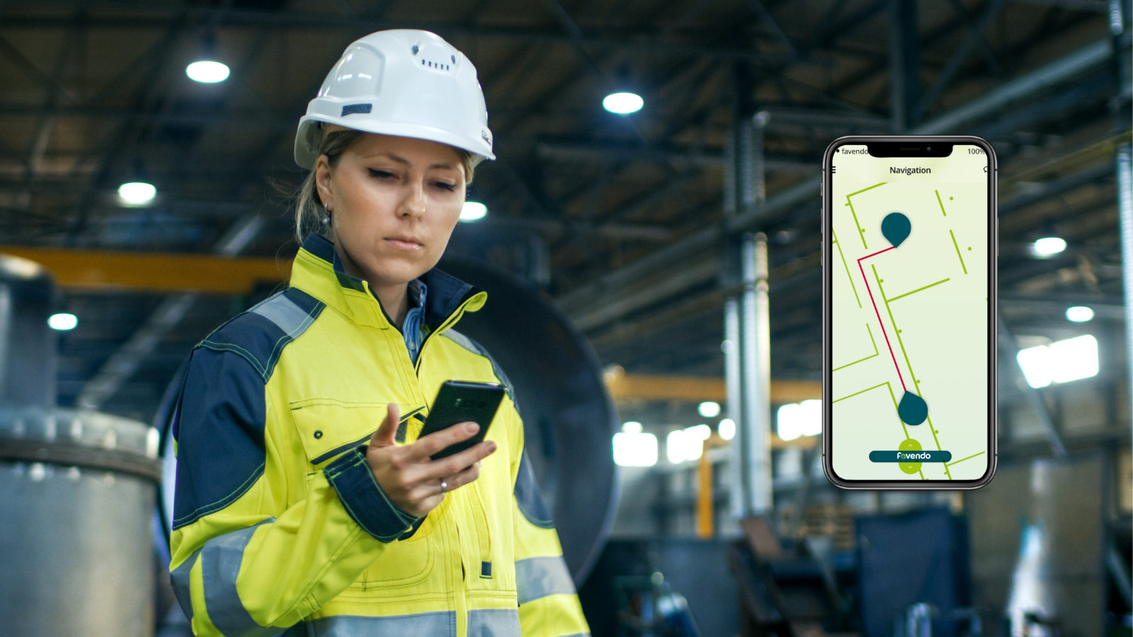
Asset Tracking and Indoor Navigation are the same thing? We didn’t say they were. But there is definitely a connection between the two services and the functionality itself is quite similar. What differentiates Asset Tracking and Indoor Navigation is the “location” where the position is calculated. In the case of the former, we talk about server-based positioning, which means that the position of the asset in question is determined on a server. Whereas in navigation, the position is calculated on the user’s device. This is called client-based positioning.

Asset Tracking: server-based positioning using sensor technologies

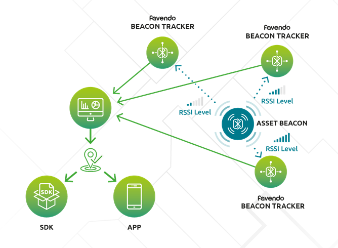
Basically, both positioning principles are based on the transmitter-receiver principle. A transmitter, in this case the asset beacon, which is attached to the object to be tracked, sends BLE signals to a beacon tracker that is permanently installed in the room. Using the RSSI method, the position of the beacon can be calculated. The stronger the signal, the closer the beacon is to the respective tracker. If at least three trackers receive the signal of a system, it is possible to precisely determine every point in a room based on the signal strength. This is known as trilateration.

Accuracy and signal coverage

A special transmitter-receiver infrastructure consisting of permanently installed beacon trackers and mobile asset beacons is therefore always required for an indoor tracking solution. It is important to ensure sufficient coverage so that the position can be determined on the basis of the signal strengths. Exactly how many trackers are needed varies from project to project and always depends on the nature of the premises. In rooms with lots of corners, coverage is more difficult to achieve and requires more precise planning than in open, straight rooms. But also the area, ceiling height or materials such as metals play a role. That’s why it’s especially important when planning an RTLS solution to call in professionals who can handle the planning and rollout of the installation and rely on their expertise.

Favendo Asset Tracking

The beacon trackers interpret the RSSI level of the asset beacon and send the received signal to the location engine. The Commander Location Engine calculates the position of the asset on the server side. This is then output via SDK or app.

Indoor Navigation: Client-based positioning with BLE wireless standard

As mentioned at […]

Things to consider when evaluating location technology

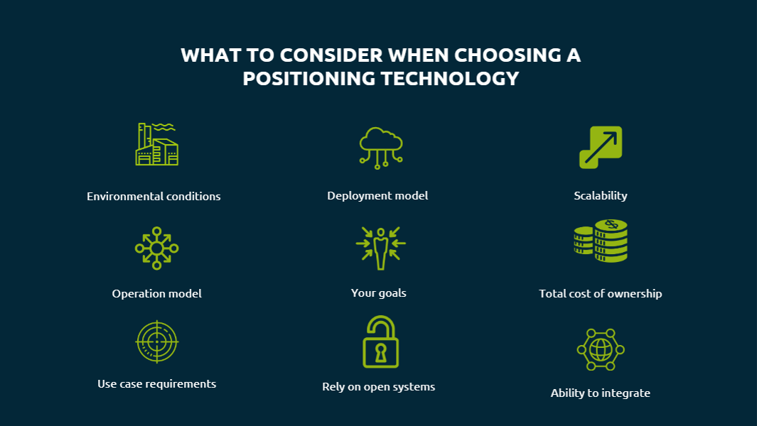
There are several questions you should ask yourself when choosing a location technology. As RTLS solution provider it’s our daily business to clarify these points with our customers during the consultation process. Nevertheless, it makes sense to agree on some framework conditions internally already, or at least to let them run through your mind before you start your evaluation process. And most important tip of all: Involve all stakeholders in the process right from the beginning.

The first thing to consider when evaluating different positioning technologies for your use case is obvious: the tracking environment. What your physical tracking area looks like will have a big impact on your choice of technology. For example, to decide on the right infrastructure, it is important to know if the area is open and if there is a line-of-sight between the anchor points and the tags. Or is the environment dusty or even explosive? The more details you can give us as an RTLS solution provider, the more customized your solution will be.

Another thing to consider early in your RTLS project planning is the deployment model. Are you comfortable with a SaaS location solution deployed in the cloud and, of course, fully data secure, or do you want to store your data locally with an on-premises model? The location of the data will not directly affect your choice of technology, but it will affect your choice of provider.

To stick to the “hard facts” as with every project – be it in business or in private – you should know your budget. And with budget we mean the total costs of ownership for a RTLS solution. In the beginning there will be somehow higher costs for the hardware, the roll-out and initial installation, while later on there will be only the licensing costs as well as potentially arising maintenance costs. However, it is important to keep them in mind even though the follow-up costs are lower than the initial ones. 

Depending on your individual use case scenario you will have requirements to be met by the positioning technology. Be it in terms of accuracy, latency or that the location solution needs to work indoors as well as outdoors. […]

Why we need Indoor Location Services

“Where am I and what is the best way to get to my destination?” is a question that each of us has probably asked ourselves more than once in our lives. Again and again we search for the right way or for locations and things – especially in unknown environments. That’s why tools have been developed to help us answer this question. In the beginning, it was a simple map or an atlas that you carried with you in the car, for example, and later the navigation system or smartphone. Nowadays, we can be navigated just about anywhere. We usually use these location services automatically several times a day. Just to check how long it will take me to get to my appointment tomorrow or whether the distance is worth it for a city trip over the weekend – everyday life.

This is made possible by satellite navigation systems known as Global Navigation Satellite Systems (GNSS). The best known of these is GPS (Global Positioning System). GPS originated in the 1970s in the military. Since 2000, GPS has also been usable for the civilian population and offers a positioning accuracy of approx. 10 m in outdoor areas. While analog street maps were still the order of the day in the 1970s, life without GPS in various devices and applications is virtually unthinkable today.

Something like Indoor GPS

GPS has revolutionized and commercialized the way we perceive our physical environment and the way we use positioning. The only issue is that GPS is a positioning technology designed for outdoor environments. However, people spend most of their time indoors. In fact, statistics suggest that about 90% of our time is spent at home, in the office, in the workshop, in the hospital, gym, shopping mall, restaurant, etc.

The added value that location-based services bring us outdoors now needs to be brought indoors. This is because indoor positioning can fundamentally change the way we perceive indoor spaces in the future and offer considerable added value. According to a study by MarketsAndMarkets in 2022, the market for […]

UWB vs. BLE: A technology comparison for indoor positioning

BLE or UWB – which technology is better for indoor positioning? We try to clarify. Because when it comes to indoor positioning, there are various technologies and a number of combinations available. But especially in the context of Industry 4.0, the question often pops up as to which technology is better for asset tracking or localization in general – BLE or UWB.

Bluetooth Low Energy and Ultra Wideband are both so-called short-range technologies that can be used to determine the positions of assets and people. So what are the differences?

How UWB works

UWB is a low-power radio technology for transmitting data in the range from 3.1 to 10.6 GHz. This broad frequency spectrum offers the advantage of not being tied to any frequency, and unused frequency capacity can be ideally utilized. Sensors attached to objects or people send a wideband signal at a specific interval to various fixed anchor points nearby, which then transmit this data to a positioning engine.

Most commonly, UWB technology is used to position objects and people using Time Difference of Arrival (TDoA). This method of position calculation has a particularly low energy consumption. Here, the positioning engine calculates the time differences of arrival to each anchor point to determine the location of the sensor with an accuracy of up to 10 cm. TDoA calculations typically require a sensor to communicate with at least 4 anchors within the line-of-sight. However, distances of up to 250 m can be achieved with a line-of-sight.

How BLE works

Bluetooth Low Energy is also a radio frequency technology. In contrast to UWB, BLE uses transmission in the 2.4 GHz band on 80 different 1 MHz channels between 2400 and 2483.5 MHz.  

In BLE tracking, sensors attached to moving objects or people communicate with trackers, i.e. permanently mounted anchor points, in the environment. If a tagged asset is within range of trackers, the positioning engine uses the signal strength (RSSI value) to calculate the object’s location. An accuracy of 3 – 5 m can be achieved. The tracker […]

How RTLS leverage to increase productivity in the mining industry

Whether in the construction industry, in furniture making, for machine tools or food packaging – steel or iron are indispensable in our everyday lives and demand is growing. And as things stand at present, fossil fuels are still required for their production. This is because coal is an essential material in the steel and iron production process. A special form of coal known as “coking coal” or “metallurgical coal” is used here. Coking coal is mainly found in Canada, Australia and the US, where it is mined in large pits.

As demand for coal increases, so does the workload in mines. One way to increase productivity in multi-layered operations such as a mine is to use an RTLS. A tracking solution can help improve operational processes and detect bottlenecks, especially in large areas. A lot of time can be saved simply by assigning work orders to the closest employee, so that as little distance as possible has to be covered between two work orders.

In addition to saving walk and search time through asset tracking in coal mining, real-time location of tools or machines helps to prevent theft or loss. Just the fact that tools are used above and below ground and in areas covering several thousand square kilometers means that things can get lost, and searching for them is usually very time-consuming. To compensate for these losses, mining companies frequently acquire a surplus of expensive equipment. This way, every piece of equipment is at hand at the right time. But this also quickly leads to misinvestments in the millions. If machines, tools or other assets can be located in real-time over the entire area of a mining site, the tools are at hand when they are needed. But without equipment overhang and immense additional costs.

The situation is similar with maintenance of mining machines. Whether dump trucks, dozers or excavators – machines used in mining are exposed to harsh environmental conditions and must work reliably. Predictive maintenance is the key to avoid breakdowns and extend the life cycle of expensive machines. With the help of special tags that, in addition to pure location data, also have integrated temperature, […]

Go to Top