Things to consider when evaluating location technology

There are several questions you should ask yourself when choosing a location technology. As RTLS solution provider it’s our daily business to clarify these points with our customers during the consultation process. Nevertheless, it makes sense to agree on some framework conditions internally already, or at least to let them run through your mind before you start your evaluation process. And most important tip of all: Involve all stakeholders in the process right from the beginning.

The first thing to consider when evaluating different positioning technologies for your use case is obvious: the tracking environment. What your physical tracking area looks like will have a big impact on your choice of technology. For example, to decide on the right infrastructure, it is important to know if the area is open and if there is a line-of-sight between the anchor points and the tags. Or is the environment dusty or even explosive? The more details you can give us as an RTLS solution provider, the more customized your solution will be.

Another thing to consider early in your RTLS project planning is the deployment model. Are you comfortable with a SaaS location solution deployed in the cloud and, of course, fully data secure, or do you want to store your data locally with an on-premises model? The location of the data will not directly affect your choice of technology, but it will affect your choice of provider.

To stick to the “hard facts” as with every project – be it in business or in private – you should know your budget. And with budget we mean the total costs of ownership for a RTLS solution. In the beginning there will be somehow higher costs for the hardware, the roll-out and initial installation, while later on there will be only the licensing costs as well as potentially arising maintenance costs. However, it is important to keep them in mind even though the follow-up costs are lower than the initial ones. 

Depending on your individual use case scenario you will have requirements to be met by the positioning technology. Be it in terms of accuracy, latency or that the location solution needs to work indoors as well as outdoors. […]

Why we need Indoor Location Services

“Where am I and what is the best way to get to my destination?” is a question that each of us has probably asked ourselves more than once in our lives. Again and again we search for the right way or for locations and things – especially in unknown environments. That’s why tools have been developed to help us answer this question. In the beginning, it was a simple map or an atlas that you carried with you in the car, for example, and later the navigation system or smartphone. Nowadays, we can be navigated just about anywhere. We usually use these location services automatically several times a day. Just to check how long it will take me to get to my appointment tomorrow or whether the distance is worth it for a city trip over the weekend – everyday life.

This is made possible by satellite navigation systems known as Global Navigation Satellite Systems (GNSS). The best known of these is GPS (Global Positioning System). GPS originated in the 1970s in the military. Since 2000, GPS has also been usable for the civilian population and offers a positioning accuracy of approx. 10 m in outdoor areas. While analog street maps were still the order of the day in the 1970s, life without GPS in various devices and applications is virtually unthinkable today.

Something like Indoor GPS

GPS has revolutionized and commercialized the way we perceive our physical environment and the way we use positioning. The only issue is that GPS is a positioning technology designed for outdoor environments. However, people spend most of their time indoors. In fact, statistics suggest that about 90% of our time is spent at home, in the office, in the workshop, in the hospital, gym, shopping mall, restaurant, etc.

The added value that location-based services bring us outdoors now needs to be brought indoors. This is because indoor positioning can fundamentally change the way we perceive indoor spaces in the future and offer considerable added value. According to a study by MarketsAndMarkets in 2022, the market for […]

UWB vs. BLE: A technology comparison for indoor positioning

BLE or UWB – which technology is better for indoor positioning? We try to clarify. Because when it comes to indoor positioning, there are various technologies and a number of combinations available. But especially in the context of Industry 4.0, the question often pops up as to which technology is better for asset tracking or localization in general – BLE or UWB.

Bluetooth Low Energy and Ultra Wideband are both so-called short-range technologies that can be used to determine the positions of assets and people. So what are the differences?

How UWB works

UWB is a low-power radio technology for transmitting data in the range from 3.1 to 10.6 GHz. This broad frequency spectrum offers the advantage of not being tied to any frequency, and unused frequency capacity can be ideally utilized. Sensors attached to objects or people send a wideband signal at a specific interval to various fixed anchor points nearby, which then transmit this data to a positioning engine.

Most commonly, UWB technology is used to position objects and people using Time Difference of Arrival (TDoA). This method of position calculation has a particularly low energy consumption. Here, the positioning engine calculates the time differences of arrival to each anchor point to determine the location of the sensor with an accuracy of up to 10 cm. TDoA calculations typically require a sensor to communicate with at least 4 anchors within the line-of-sight. However, distances of up to 250 m can be achieved with a line-of-sight.

How BLE works

Bluetooth Low Energy is also a radio frequency technology. In contrast to UWB, BLE uses transmission in the 2.4 GHz band on 80 different 1 MHz channels between 2400 and 2483.5 MHz.  

In BLE tracking, sensors attached to moving objects or people communicate with trackers, i.e. permanently mounted anchor points, in the environment. If a tagged asset is within range of trackers, the positioning engine uses the signal strength (RSSI value) to calculate the object’s location. An accuracy of 3 – 5 m can be achieved. The tracker […]

How RTLS leverage to increase productivity in the mining industry

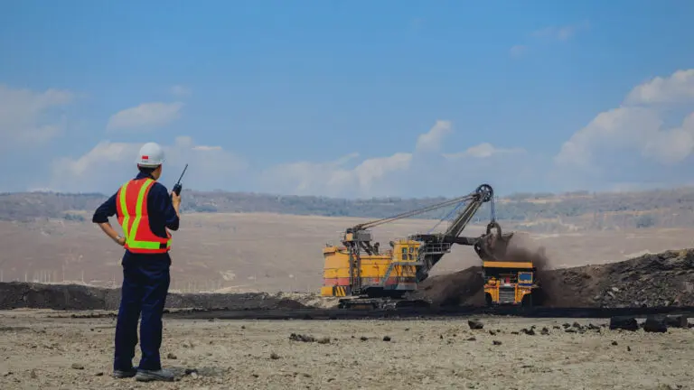
Whether in the construction industry, in furniture making, for machine tools or food packaging – steel or iron are indispensable in our everyday lives and demand is growing. And as things stand at present, fossil fuels are still required for their production. This is because coal is an essential material in the steel and iron production process. A special form of coal known as “coking coal” or “metallurgical coal” is used here. Coking coal is mainly found in Canada, Australia and the US, where it is mined in large pits.

As demand for coal increases, so does the workload in mines. One way to increase productivity in multi-layered operations such as a mine is to use an RTLS. A tracking solution can help improve operational processes and detect bottlenecks, especially in large areas. A lot of time can be saved simply by assigning work orders to the closest employee, so that as little distance as possible has to be covered between two work orders.

In addition to saving walk and search time through asset tracking in coal mining, real-time location of tools or machines helps to prevent theft or loss. Just the fact that tools are used above and below ground and in areas covering several thousand square kilometers means that things can get lost, and searching for them is usually very time-consuming. To compensate for these losses, mining companies frequently acquire a surplus of expensive equipment. This way, every piece of equipment is at hand at the right time. But this also quickly leads to misinvestments in the millions. If machines, tools or other assets can be located in real-time over the entire area of a mining site, the tools are at hand when they are needed. But without equipment overhang and immense additional costs.

The situation is similar with maintenance of mining machines. Whether dump trucks, dozers or excavators – machines used in mining are exposed to harsh environmental conditions and must work reliably. Predictive maintenance is the key to avoid breakdowns and extend the life cycle of expensive machines. With the help of special tags that, in addition to pure location data, also have integrated temperature, […]

The impact of location technology on fan engagement in sports and what it has to do with Netflix

It has now been over 2.5 years since the World Health Organization declared Covid-19 a global pandemic in March 2020. For a long time, therefore, public life was almost at a standstill and most people spent a lot of time at home. Much that originally took place in presence suddenly existed – if at all – only in a digital way and events, such as soccer matches, took place in front of empty stands.

One might now assume that the ghost games have increased the number of viewers in front of their TV screens at home. But the opposite is the case. Viewing figures in Germany for soccer matches – whether in the Bundesliga or international games – fell significantly during the corona pandemic. This also has an impact on fan engagement. It is therefore all the more important for soccer clubs to bring fans back to the stadium. But how can this be achieved when sports are now competing with streaming providers such as Netflix, people’s habits have changed as a result of the pandemic, and the sofa is so much more comfortable than a standing or, in the best case, sitting position in the stadium?

Fan experience is key

What actually motivates fans to watch sporting events like soccer matches live in the stadium? The decisive factor is the experience gained on site: Watching a game or a competition together with other fans, cheering or shaking together – that’s what unites people. The good atmosphere in the stadium, the exchange with like-minded people, an appealing stadium design and the opportunity to pass the time at kiosks or fan stores during breaks. These are all factors that help to create a positive fan experience.

And the more positive this fan experience is, the more likely it is that fans will come back. Not only that, but they are likely to tell others about their positive experience or even motivate others to come along on their next visit.

Improving fan experience with location-based services

In addition […]

Building the future of the construction industry with flexible location services

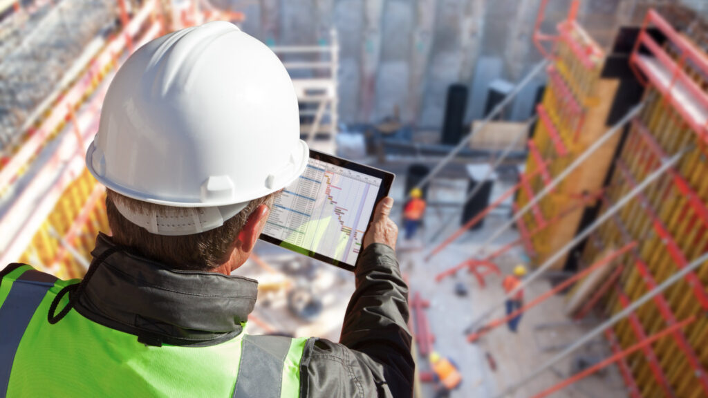
It is no coincidence that large construction projects often have the reputation of exceeding every previously set budget and usually taking much longer than planned. On the one hand, construction projects are becoming more and more complex with increasingly tight schedules, but at the same time the construction industry is one of the sectors in which digital transformation is still in its infancy, especially regarding project and process management.

Yet a large construction site is in many ways like a temporary industrial enterprise. Numerous assets of different sizes are used in a limited space to produce a large “(end) product”. As in classic production facilities, it makes sense to use digital asset management tools here as well. In this way, inefficiencies and information losses (so-called bottlenecks) that lead to cost overruns, schedule delays and a general project risk can be avoided.

How to avoid unnecessary search times at construction sites

Often the main problem is not knowing where the damn thing you are looking for is. Be it material, tools or a machine. So a typical case of lost productivity and resources due to unnecessary search time and potential loss of material and equipment. This is where Real Time Location Services in the broader sense and Asset Tracking Systems in the narrower sense come into play and provide visibility and transparency.

Of course, the lifecycle of a construction site is somewhat different from that of a static production plant. While industrial companies usually only cover indoor areas with tracking solutions, the tracking system of a construction site has to remain flexible and “grow” with it, so to speak, from outdoor to primarily indoor tracking. This makes it an ideal location for an indoor/outdoor combination solution with GPS & Bluetooth (BLE), in which data is transmitted via LoRa antenna.

While the outdoor theme is covered during the entire construction phase via GPS tracking, the BLE installation virtually grows with the building. The mobile assets that are to be tracked are equipped with multi-mode trackers. These then calculate their position either via GPS or – as soon as the building shell is closed – based on BLE signals […]

#OneFit4All – How digital solutions simplify everyday hospital life

Simplifying processes and saving resources are now more than ever the major topics of digitization in the healthcare sector. However, the time and financial effort that seems necessary is causing many long overdue projects to fall further and further behind schedule.

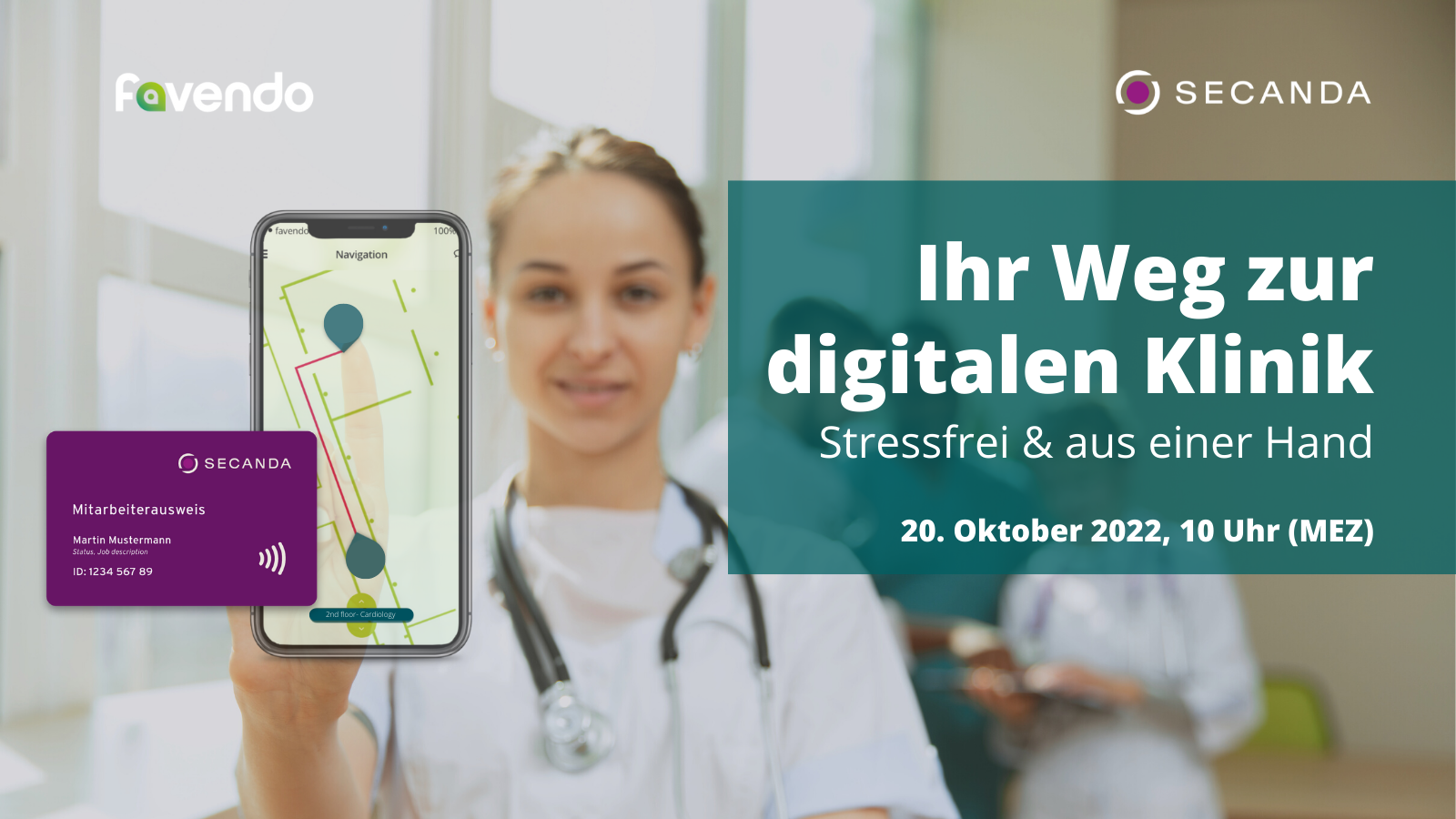
That’s why Favendo and SECANDA have teamed up to offer an effective centralized solution for authorization management, identification and localization from a single source, which improves processes in everyday hospital life, saves time and money, and makes day-to-day work easier for everyone involved.

At the heart of the solution is a simple implementation process with an API that bundles various applications and provides user-friendly features.

These are the benefits offered by the joint digital solution for clinics:

Increase security

With the SECANDA system, each person receives a single ID to identify themselves anywhere in the system using the same app or smart card. One medium for payment transactions, time and attendance, identification, as well as for unlocking and locking. This enables automated data management while reducing security gaps. Authorization management happens in real time for all apps, regardless of employee badge (or other medium).

Reduce search times

Medical asset tracking with a Real Time Location System (RTLS) from Favendo helps clinicians to locate medical equipment as quickly as possible. This is not only beneficial in medical emergencies for better patient care, but also helps you save resources and avoid “safety purchases” for expensive equipment.

Improve orientation

Hospitals are usually complex multi-level buildings and often the wards are even spread over several buildings. This poses challenges for visitors and patients looking for their rooms or treatment rooms, but quite possibly also for staff or external service providers, such as maintenance and cleaning companies. To counteract this, Favendo offers a Bluetooth-based indoor navigation that helps everyone find the right way quickly. If an infrastructure with Bluetooth-enabled WLAN access points is already in place, these can be used for the navigation solution, thus saving costs for the hardware infrastructure.

Optimize processes

Thanks to the SECANDA software solution, staff, […]

Technology compared: Which positioning technology fits your use case?

There are countless use cases for location or tracking solutions – both indoor and outdoor. Finding the right technology for the respective use case is a very complex task: What are the wishes and current requirements for the technology, and which could arise in the future? Once these points have been clarified, the next step is to compare technologies.

First of all, it is often a mistake to confuse technology and methodology, or to lump the terms together. For example, Bluetooth, WiFi or GPS are (radio) technologies used for positioning, while RSSI or AoA are the methods used to determine a location.

Just like use cases, there are also countless location technologies that work with specific methods. To go into all of them in depth would definitely go beyond the scope of this article and would require an enormous breadth of expert knowledge that Favendo alone cannot cover. Of course, we have tested various solutions over the past 10 years and learned from our customers’ experiences, but we still don’t know everything 😊. Therefore, in this article we limit ourselves to the technologies and methods that Favendo uses for RTLS solutions. Of course, this implies that this comparison is neither complete nor completely neutral. Nevertheless, we hope that the overview will help a little in the decision-making process or inspire you to discuss internally – or, of course, directly with us.

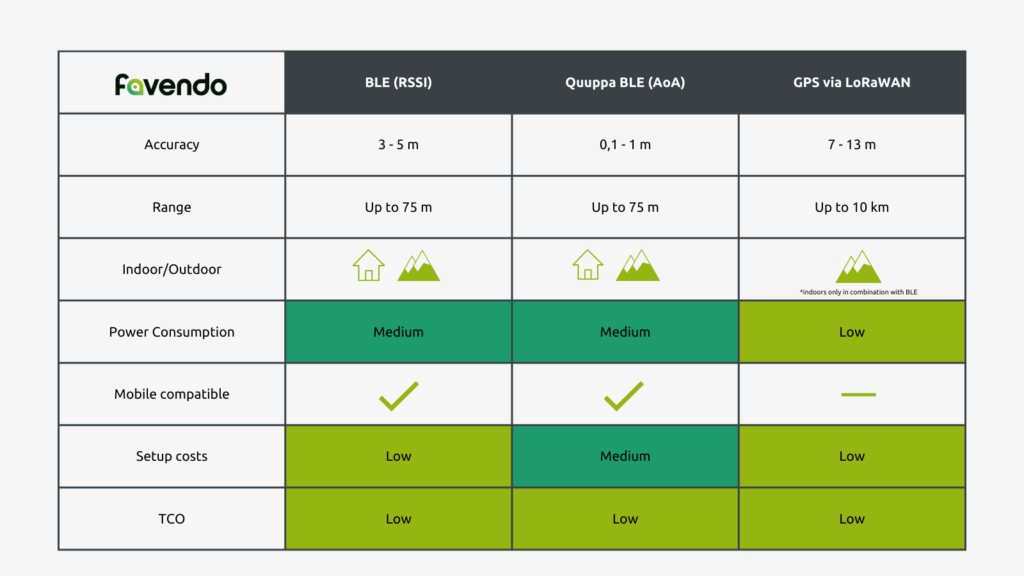
BLE (RSSI)

Bluetooth Low Energy with the RSSI (Received Signal Strength Indicator) method is the hobbyhorse of Favendo’s positioning and navigation solutions. BLE RSSI works with beaconing, which means that the mobile beacons transmit Bluetooth signals and corresponding fixed trackers measure the received signal strength to locate the tagged object.

In this way, an accuracy of 3-5 m can be achieved with indoor positioning and precise planning of the infrastructure. We also call this room-accurate positioning. With BLE RSSI, both tracking and navigation solutions can be implemented in real time. The big advantage is that the infrastructure costs and TCO of a BLE RSSI solution are very low.

BLE (AoA)

Like BLE […]

Go to Top